The hinterlands of Asia, including Northwestern China, Central Asia, the Caspian region, and most of Western Asia, form the core area of the ancient Silk Road and the modern initiatives of "Belt and Road" and "Eurasian Land Bridge." Known as the "crossroads" of Eastern and Western civilizations, this region is characterized by a sequence of closed endorheic basins, spanning vast areas with predominantly arid and semi-arid climates, where the ecological environment is fragile. Amid global warming and increasing human activity, the arid river basins of Asia’s interior face serious sustainable development challenges.
Ma Xuanlong's research group from the College of Earth and Environmental Sciences, utilizing satellite data from 2000 to 2021—including optical satellites (MODIS), precipitation measurement satellites (GPM), and gravity recovery satellites (GRACE)—combined with meteorological observations, has studied the trends of vegetation changes and their hydro-meteorological driving factors over the past two decades in Asia’s arid river basins. The findings indicate a significant "greening" trend (manifested as an increase in aboveground biomass of vegetation), primarily in the "extremely arid" and "arid" zones, which have seen less rainfall. Furthermore, despite minimal changes in rainfall, the region’s terrestrial water storage (surface and groundwater), measured by gravity satellites, has shown a consistent and substantial "water loss" trend, with an average regional cumulative water storage change of -0.42 m over twenty years. The study also highlights the significant role of human activities, particularly the extensive expansion of irrigated farmland and the resulting increase in irrigation water use, as the main reasons for the "greening" and "water loss" in these areas. Finally, aligning with the United Nations 2030 Sustainable Development Goals (SDGs), the research discusses the challenges posed by large-scale "greening" and "water loss" in Asia’s arid inland basins to regional sustainable development.
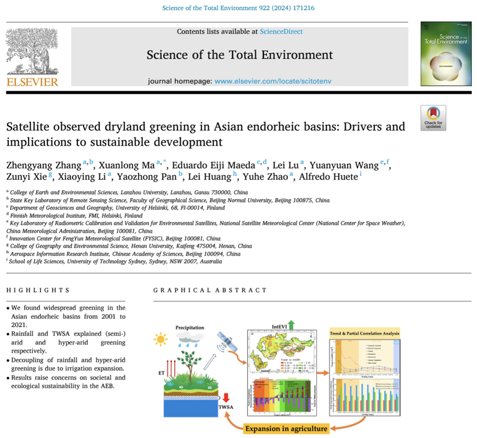
Figure 1:Front page of the paper Figure.
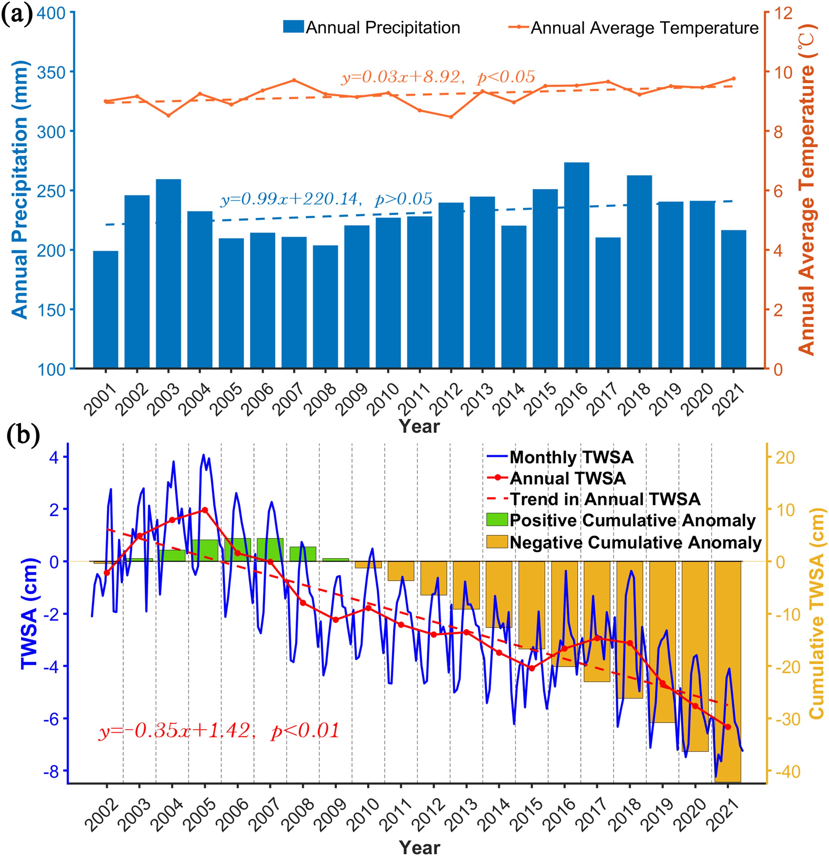
Figure 2:Graph showing trends in average air temperature, precipitation, and terrestrial water storage (TWSA) in Asia’s arid river basins from 2001 to 2021.
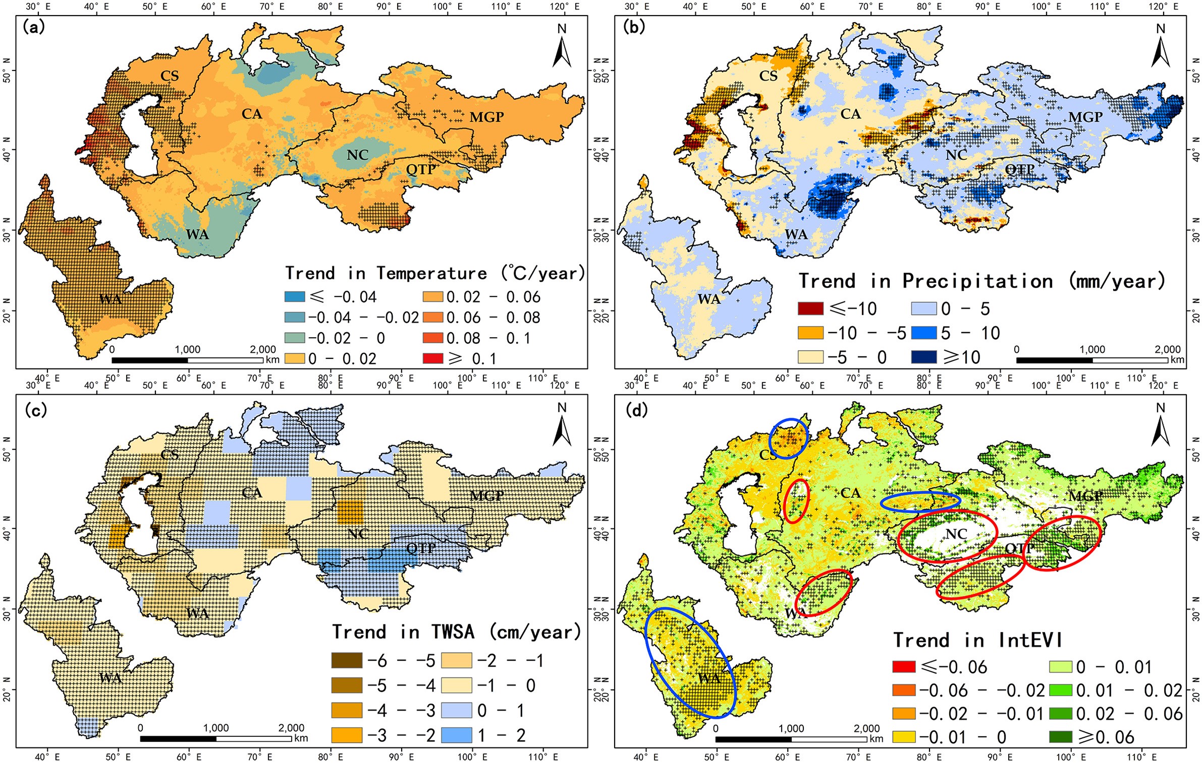
Figure 3: Spatial patterns of changes in air temperature, precipitation, terrestrial water storage, and vegetation index during the growing season in Asia’s arid river basins from 2001 to 2021.
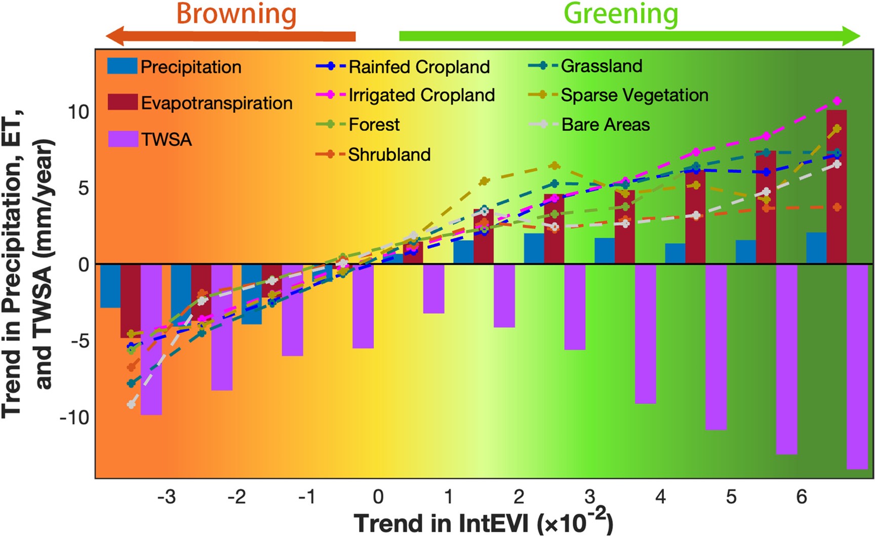
Figure 4: Trends in rainfall (P), evapotranspiration (ET), and terrestrial water storage across different gradients of vegetation index (IntEVI) in Asia’s arid river basins from 2001 to 2021. Dotted lines indicate ET trends for major vegetation types under different gradients.
This research, recently published in the international environmental science and ecology journal "Science of The Total Environment" (Impact Factor = 9.8, top-tier), is titled "Satellite observed dryland greening in Asian endorheic basins: Drivers and implications to sustainable development." Zhang Zhengyang, a 2020 master's student at the college, is the lead author of the paper, with Ma Xuanlong serving as the corresponding author. The study was funded by the National Natural Science Foundation of China (grant number 42171305) and an International (Regional) Cooperation and Exchange Project (grant number 42311540014).
Paper link:https://doi.org/10.1016/j.scitotenv.2024.171216